The overall goal of the Global Ecosystem Dynamics Investigation (GEDI) mission is to
advance our ability to characterize the effects of changing climate and land use on
ecosystem structure and dynamics. The GEDI instrument produces high-resolution laser
ranging observations of the 3-dimensional structure of the Earth. GEDI is attached to the
International Space Station (ISS) and collects data globally between 51.6o N and 51.6o S
latitudes. GEDI measurements of forest canopy height, canopy vertical structure, and
surface elevation are used to characterize important carbon and water cycling processes,
biodiversity, and habitat. The GEDI data also may be used in far ranging applications
such as weather forecasting, forest management, snow and glacier monitoring, and digital
elevation models. GEDI is led by the University of Maryland in collaboration with NASA
Goddard Space Flight Center. GEDI science data algorithms and products are created
by the GEDI Science Team.
Comments
A world event
Pardon me, but you are on a game website. What kind of "world event" are you thinking of. What am I missing here?
@gedi Good for you!
when I checked that game number I didn't see any jedi mentioned in the scoring . maybe darth erased it ...
Global Ecosystem Dynamics Investigation - NASA - see Website
The overall goal of the Global Ecosystem Dynamics Investigation (GEDI) mission is to
advance our ability to characterize the effects of changing climate and land use on
ecosystem structure and dynamics. The GEDI instrument produces high-resolution laser
ranging observations of the 3-dimensional structure of the Earth. GEDI is attached to the
International Space Station (ISS) and collects data globally between 51.6o N and 51.6o S
latitudes. GEDI measurements of forest canopy height, canopy vertical structure, and
surface elevation are used to characterize important carbon and water cycling processes,
biodiversity, and habitat. The GEDI data also may be used in far ranging applications
such as weather forecasting, forest management, snow and glacier monitoring, and digital
elevation models. GEDI is led by the University of Maryland in collaboration with NASA
Goddard Space Flight Center. GEDI science data algorithms and products are created
by the GEDI Science Team.
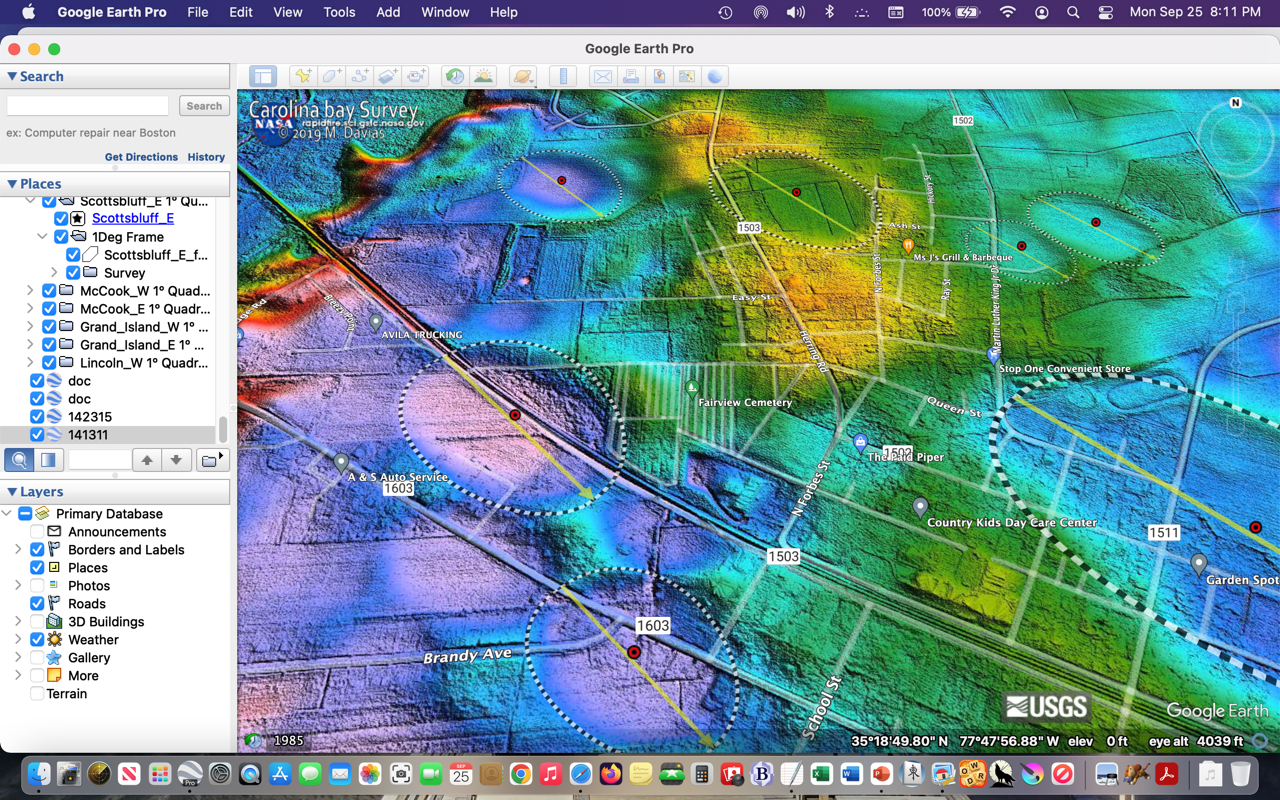
If anyone is interested in Lidar Data, here is an example of it's use. We use it to locate Carolina Bays.
Wow...@jayG. Very impressed.
Thank you @jayg, thank you and your coworkers and contributors for their dedication to saving our home.